


China develops "space-ground information ports"
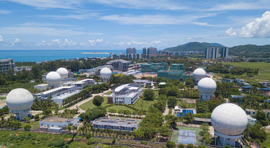
An aerial drone photo taken on July 5, 2024 shows China's remote sensing satellite ground station in Sanya, south China's Hainan Province. (Xinhua/Pu Xiaoxu)
BEIJING, Sept. 25 (Xinhua) -- Searching for dark matter and black holes; taking high-definition images of the Earth; monitoring fires, earthquakes and mudslides, these are just a few tasks supported by the data from some 50 Chinese scientific and Earth observation satellites currently in orbit.
Day and night, huge volumes of data pours into China's satellite ground stations, which serve as space-ground information ports.
In recent years, China's rapid development of the space industry has significantly increased demand for satellite data reception. According to Li Tong, deputy director of the China Remote Sensing Satellite Ground Station and senior engineer at the Aerospace Information Research Institute under the Chinese Academy of Sciences, China's remote sensing satellite ground stations play an important role in advancing scientific research and supporting industrial applications.
Over three decades, China has built an operational system of remote sensing satellite ground stations. Headquartered in Beijing, this network includes five ground stations in Miyun in suburban Beijing; Kashgar in northwest China's Xinjiang Uygur Autonomous Region; Sanya on south China's island province of Hainan; Lijiang in southwest China's Yunnan Province; and Mohe, China's northernmost city.
Currently, the system boasts 38 large-diameter data receiving antennas and multiple high-speed fiber-optic data transmission links, enabling real-time data reception across the totality of China's territory, said Li.
These ground stations support data reception for all civil land observation and space science satellites. Since 1986, they have managed data for more than 70 domestic and international satellite missions, amassing over 600 terabytes of historical data.
The stations have been crucial for various national projects, including land surveys, ecological monitoring, and forest assessments. They also play a key role in disaster response, by providing timely data acquisition and monitoring during major natural disasters both domestically and abroad.
In 2023 alone, the ground stations delivered rapid mapping and data services for significant disasters in 16 countries, including Türkiye, Syria, New Zealand, and Peru, processing more than 1.2 terabytes of data from 22 domestically produced satellites.
Looking ahead, the ground stations plan to enhance their remote sensing information engineering by exploring intelligent data processing, and offering multi-resolution and diversified data product services, Li said.
Photos


Related Stories
- China's Smart Dragon-3 rocket launches 8 satellites from sea
- China to launch moon base mission as early as 2026, expected to be equipped with wireless network
- China to provide more diverse food for deep-space exploration missions
- China's space medicine progress to contribute to future space exploration
- Yutu-2 becomes world’s longest-working lunar rover
Copyright © 2024 People's Daily Online. All Rights Reserved.
 狠狠噜狠狠狠狠丁香五月